
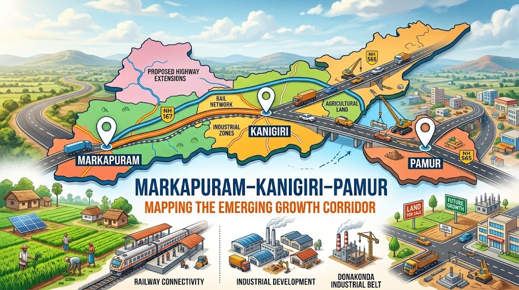
Markapuram–Kanigiri–Pamur is attracting increasing attention as an emerging regional growth corridor in Andhra Pradesh. The region combines agricultural land, expanding road connectivity, proposed industrial development, railway infrastructure, water resources and access to larger economic centres.
For people researching land investment in Andhra Pradesh, farmland near Markapuram, agricultural land near Kanigiri, or land for sale near Pamur, understanding the infrastructure and development map is important before evaluating any individual property.
The growth story of this region is not based on a single project. Instead, it is shaped by multiple potential growth drivers across Markapuram, Kanigiri, Pamur and the wider Donakonda industrial belt.
Markapuram–Kanigiri–Pamur: Why Is This Region Getting Attention?
The region is strategically positioned between several established towns and transport networks in Andhra Pradesh.
The broader development picture includes:
- Industrial development around Donakonda
- Proposed Prakasam National Investment and Manufacturing Zone (NIMZ) around Pamur and Pedacherlapalli
- Existing and planned road connectivity
- Railway network expansion proposals
- Agricultural and plantation activity
- Irrigation tanks and reservoirs
- Growing demand for residential and commercial infrastructure
- Education, healthcare and other social infrastructure
- Large land parcels suitable for different development and agricultural purposes
APIIC describes the proposed Donakonda Industrial Node as having strategic significance for industrialisation and identifies opportunities to strengthen connections with road, rail and other logistics networks. Its 2025 PPP expression-of-interest document also identifies a proposed 380-acre industrial park at Donakonda.
These developments make it useful to look at the region as a connected growth corridor rather than evaluating each town in isolation.
1. Markapuram – A Regional Centre with Multiple Growth Drivers
Markapuram functions as an important regional centre for surrounding mandals and villages.
The official Markapuram district profile identifies Markapur, Giddalur and Kanigiri among its Assembly constituencies and notes significant agricultural activity supported by irrigation sources including the Nagarjuna Sagar Project, Cumbum Tank, Mopadu Reservoir and hundreds of minor irrigation tanks.
This agricultural base is important when considering the region’s land-use potential.
The area can broadly support several types of land-related activity:
- Agricultural land
- Horticulture
- Plantation farming
- Farm-based development
- Residential expansion
- Commercial development
- Industrial-support activities
For farmland buyers, the combination of agricultural activity and improving connectivity can make Markapuram agricultural land an area worth researching.
However, agricultural land should not automatically be considered suitable for residential or commercial development. Land-use permissions and local regulations must be verified for each property.
2. Kanigiri – A Strategic Link Between Regional Markets
Kanigiri occupies an important position within the wider regional road network.
The Andhra Pradesh Roads & Buildings Department lists a substantial road network under its Kanigiri division, including State Highways, Major District Roads and Other District Roads. The department reports more than 1,377 km of roads under the Kanigiri division, across different road classifications.
Road connectivity is particularly relevant to land investors because accessibility influences:
- Travel time
- Transportation costs
- Agricultural logistics
- Access to nearby towns
- Development feasibility
- Demand for surrounding land
The broader corridor also connects with NH-565, an important north-south road connection through the region. APIIC’s Donakonda industrial-development document specifically identifies NH-565 as connecting the Hyderabad–Chennai direction and highlights road and rail connectivity as part of the industrial-node strategy.
For people searching for land investment near Kanigiri, connectivity should therefore be evaluated at the individual-property level rather than simply relying on the name of the town.
3. Pamur – The Industrial Development Connection
Among the most important development factors in the wider corridor is the proposed Prakasam NIMZ.
According to APIIC, the proposed Prakasam NIMZ falls within Pamur and Pedacherlapalli mandals and is associated with the Vizag–Chennai Industrial Corridor (VCIC).
APIIC lists a proposed extent of approximately 14,231 acres for the Prakasam NIMZ and identifies substantial projected infrastructure expenditure and economic activity associated with the proposal.
This does not mean that all surrounding land will become industrial land or that every nearby property will appreciate.
Instead, it indicates why Pamur and the surrounding region are important to monitor from an infrastructure and economic-development perspective.
For investors researching:
“land for sale near Pamur”
or
“Pamur land investment opportunities”
the proposed industrial ecosystem is one of several factors that deserves investigation.
4. Donakonda – An Important Industrial Growth Node
Donakonda is one of the major development points connected to the broader Markapuram–Kanigiri–Pamur region.
APIIC’s 2025 document describes the proposed Donakonda Industrial Node as strategically significant and states that its development is aligned with the broader National Industrial Corridor Development Programme framework.
The document also describes planned industrial, residential, commercial and green-space components within the proposed industrial cluster.
The same APIIC document identifies:
- Donakonda Industrial Cluster
- Road connectivity
- Railway connectivity
- Industrial infrastructure
- Logistics potential
- Proposed industrial park development
as important components of the development strategy.
This creates an important geographical relationship:
Markapuram → Kanigiri → Pamur → Donakonda
Rather than viewing these locations as completely independent markets, investors can examine how infrastructure and economic activity may connect them over time.
5. Railway Infrastructure Could Add Another Layer of Connectivity
Railway development is another important factor when mapping the region.
South Central Railway has described the Nadikudi–Kalahasti railway project as a major expansion of the railway network in Andhra Pradesh.
The project phases include sections connecting:
- Darsi–Kanigiri
- Kanigiri–Pamur
- Pamur–Obulayyapalle
- Other sections forming part of the wider network
South Central Railway has stated that the project is intended to provide an alternative route to the existing coastal railway line and facilitate freight movement through the mineral-rich belt.
For land investors, railway infrastructure can be relevant because freight movement, passenger connectivity and logistics can influence future economic activity.
At the same time, proximity to a proposed railway line should never be treated as a guaranteed increase in property value. Exact alignment, station locations, acquisition requirements and project execution need to be independently verified.
6. Road Connectivity: One of the Key Growth Indicators
Road infrastructure is one of the easiest ways to understand regional accessibility.
The Prakasam district Roads & Buildings Department maintains an extensive network covering the Kanigiri and Markapur divisions. The department reports:
- 1,377.661 km under the Kanigiri division
- 1,033.695 km under the Markapur division
covering State Highways, Major District Roads and other district roads.
This network connects villages, agricultural areas, mandal headquarters and regional towns.
For farmland buyers, road access is especially important because it can influence:
- Farm accessibility
- Transportation of agricultural inputs
- Produce movement
- Labour access
- Farm maintenance
- Emergency access
- Future development possibilities
Therefore, when purchasing agricultural or plantation land, “How far is the nearest motorable road?” is often more useful than simply asking how far the property is from a major city.
7. Agriculture and Irrigation Remain Important
While industrial development receives considerable attention, agriculture remains a fundamental part of the regional economy.
The official Markapuram district profile identifies the Nagarjuna Sagar Project, Cumbum Tank, Mopadu Reservoir and 546 minor irrigation tanks, with the latter supporting an ayacut of approximately 80,735 acres.
This creates opportunities for agricultural activities such as:
- Horticulture
- Orchards
- Plantation farming
- Agroforestry
- Crop cultivation
- Farm-based enterprises
However, water availability can vary significantly from one village or survey number to another.
Anyone considering agricultural land investment in Andhra Pradesh should verify:
- Source of irrigation
- Borewell feasibility
- Existing water rights
- Tank/canal proximity
- Seasonal water availability
- Soil suitability
- Electricity availability
- Road access
A property being located in an irrigation-supported district does not automatically mean that every individual parcel has assured irrigation.
8. Why Large Land Parcels Are Being Watched
One characteristic of the broader Markapuram–Kanigiri–Pamur belt is the availability of comparatively larger land parcels in rural areas.
This can attract interest from:
- Farmers
- Plantation developers
- Agroforestry operators
- Long-term land investors
- Farmhouse buyers
- Agricultural entrepreneurs
- Industrial-support businesses
Large land parcels can offer different opportunities from small urban plots, but they also require more extensive due diligence.
Before purchasing farmland, buyers should verify:
Title & Ownership
- Parent documents
- Current title
- Encumbrance certificate
- Registration records
- Survey details
Land Records
- 1-B
- Adangal
- Pattadar/passbook records where applicable
- Survey and subdivision details
Land Use
- Agricultural classification
- Conversion requirements
- Applicable zoning
- Restrictions on development
Physical Verification
- Exact boundaries
- Road access
- Water availability
- Electricity
- Neighbouring land
- Survey stones
- Actual possession
9. The Emerging Corridor Is Bigger Than One Town
A common mistake when analysing emerging land markets is looking at only one village or town.
A better approach is to map the entire ecosystem.
Markapuram
Regional centre + agriculture + services + surrounding rural markets
↓
Kanigiri
Road connectivity + regional commercial activity + access to surrounding mandals
↓
Pamur
Proposed NIMZ connection + VCIC relationship + agricultural land
↓
Donakonda
Industrial development proposals + logistics and connectivity potential
This interconnected view helps explain why the phrase “Markapuram–Kanigiri–Pamur growth corridor” can be useful when researching the region.
10. Industrial Development Can Create Secondary Demand
Industrial development does not only create factories.
A large industrial ecosystem can potentially require supporting services such as:
- Warehousing
- Logistics
- Transport
- Housing
- Restaurants
- Retail
- Education
- Healthcare
- Worker accommodation
- Commercial services
- Agricultural supply chains
APIIC’s stated objectives include development of infrastructure such as factory sites, warehouses, communications, power, water, housing, hospitals and educational institutions to support industrial and commercial growth.
This is why land investors often study industrial development together with residential, commercial and agricultural trends.
However, the actual timing and scale of secondary demand depends on the implementation of individual projects.
11. Farmland Investment: What Should Buyers Look For?
For buyers specifically interested in farmland for sale near Markapuram, Kanigiri or Pamur, location alone should not be the deciding factor.
A strong due-diligence checklist should include:
1. Clear Title
Confirm ownership history and legal title through qualified professionals.
2. Registration Status
Verify that the seller has the legal authority to sell the property.
3. Survey Verification
Match the registered documents with the actual survey number and physical boundaries.
4. Road Access
Confirm legally recorded and physically usable access.
5. Water
Check the actual water source rather than relying on general regional claims.
6. Electricity
Verify existing or legally available electricity infrastructure.
7. Land Classification
Confirm whether the land is agricultural and whether the intended use is legally permissible.
8. Development Permissions
For plotted or developed farmland projects, verify applicable approvals and permissions.
9. Encumbrances
Conduct appropriate searches for mortgages, disputes, attachments or other claims.
10. Physical Site Inspection
Visit the property before making a purchase decision.
12. Why 2026 Is an Important Year to Study the Region
The year 2026 is significant for researching this corridor because several development themes can now be examined together rather than individually.
These include:
Industrial Development
Donakonda’s industrial-development proposals provide a major long-term regional growth theme.
Manufacturing
The proposed Prakasam NIMZ around Pamur and Pedacherlapalli represents another large-scale industrial-development proposal.
Rail Connectivity
The planned railway network includes proposed sections involving Kanigiri and Pamur.
Road Infrastructure
The region already has extensive State Highway and district-road networks serving Kanigiri and Markapur divisions.
Agriculture
Agriculture and irrigation remain significant components of the local economy.
Together, these factors make the corridor worth monitoring from a land-use, infrastructure and economic-development perspective.
13. Markapuram–Kanigiri–Pamur vs. Established Growth Corridors
Emerging regions are sometimes compared with established growth areas such as Hyderabad’s outskirts, Patancheru or other industrial corridors.
Such comparisons can help explain the concept of a growth corridor, but they should not be interpreted as predictions.
Every region has different:
- Infrastructure
- Population
- Industrial base
- Government policies
- Land availability
- Water resources
- Employment patterns
- Urbanisation rates
- Investment levels
Therefore, Markapuram–Kanigiri–Pamur should be evaluated on its own fundamentals rather than assuming it will replicate another city’s development pattern.
14. What Could Drive Future Land Demand?
Several factors could influence land demand across the wider corridor.
Industrialisation
New industrial projects can create demand for supporting infrastructure and services.
Better Connectivity
Improved roads and railway connectivity can increase accessibility.
Employment
Industrial and commercial activity can potentially create local employment opportunities.
Urban Expansion
Growing economic activity can increase demand for residential and commercial services.
Agriculture
Agricultural productivity and plantation development can continue supporting rural land demand.
Logistics
Industrial corridors can increase demand for transportation and storage facilities.
Infrastructure Investment
Public and private investment can influence the attractiveness of specific locations.
These are potential demand drivers, not guarantees of appreciation.
15. How to Identify a Strategic Land Parcel
When comparing properties in the Markapuram–Kanigiri–Pamur region, consider creating a simple location scorecard based on facts rather than promotional claims.
Evaluate:
| Factor | What to Check |
|---|---|
| Road Access | Distance and legal access to an all-weather road |
| Railway | Existing/proposed railway connectivity |
| Industrial Projects | Distance from officially documented projects |
| Water | Actual source and availability |
| Electricity | Existing connection/infrastructure |
| Title | Clear ownership and legal documentation |
| Land Use | Current classification and permitted use |
| Development | Existing approvals, where applicable |
| Nearby Town | Distance to essential services |
| Physical Site | Boundaries, soil, terrain and access |
| Future Projects | Officially documented status |
| Price | Comparable local transactions and market evidence |
This approach helps separate genuine location fundamentals from marketing narratives.
16. The Bigger Picture: From Agricultural Region to Multi-Use Economic Corridor
The most important feature of the Markapuram–Kanigiri–Pamur region is the combination of different economic activities.
It is not simply an industrial story.
It is a combination of:
Agriculture + Infrastructure + Industry + Logistics + Services + Urbanisation
The proposed industrial developments around Donakonda and Pamur are important parts of this picture, while Markapuram and Kanigiri provide regional connectivity and services.
The result is a corridor that deserves continued monitoring as infrastructure and development projects progress.
Conclusion: Mapping the Markapuram–Kanigiri–Pamur Growth Story
The Markapuram–Kanigiri–Pamur region represents an emerging development geography in Andhra Pradesh where several potential growth drivers intersect.
The proposed Donakonda Industrial Node, Prakasam NIMZ around Pamur, railway connectivity proposals involving Kanigiri and Pamur, extensive road infrastructure, agricultural activity and irrigation resources collectively make this region important to study for people considering land and farmland opportunities.
For a prospective land buyer, however, the most important question is not simply:
“Will land prices increase?”
A better question is:
“Does this particular property have strong fundamentals, clear documentation, good access, suitable land use and genuine connectivity to the region’s development ecosystem?”
That distinction is essential.
The Markapuram–Kanigiri–Pamur growth corridor may continue to evolve as industrial, infrastructure and agricultural activities develop. Investors researching land investment in Andhra Pradesh, farmland near Markapuram, agricultural land near Kanigiri, Pamur land investment and Donakonda industrial growth should therefore combine regional research with property-level legal and technical due diligence.